 Everest Climbing Tours
How Tall Is Mount Everest? The Mount Everest Height in Metres and Feet
The Mount Everest height is 8,848.86 m (29,031.7 ft), the figure from the joint Nepal-China survey announced after the 2020 fieldwork. This page collects every official height the mountain has carried, explains why the numbers moved, and compares Everest with K2, Kangchenjunga, Mauna Kea and Chimborazo. It also sets the trekkers' points beside the summit, because Lukla, Namche Bazaar, base camp and Kala Patthar all sit far lower than the top. If you want to see the mountain without climbing it, Everest tours include scenic flights, treks and helicopter landings. Climbing the mountain itself is covered on the climbing Mount Everest page.
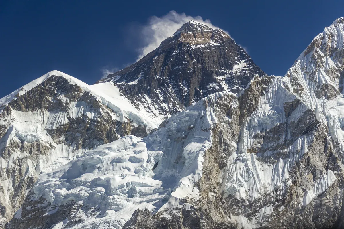
Everest from Kala Patthar. Photo: Bijay Chaurasia, CC BY-SA 4.0, via Wikimedia Commons
Quick answer Mount Everest height at a glance
Mount Everest is 8,848.86 m (29,031.7 ft) high. That is the official Mount Everest height from the joint Nepal-China survey announced after fieldwork finished in 2020. Earlier official figures were 8,840 m in 1856, 8,848 m from the 1954 Survey of India work, and 8,844.43 m from China's 2005 rock-height survey. The mountain still grows about 2 mm per year. Trekkers reach points far below the summit: base camp sits at 5,364 m (17,598 ft) and Kala Patthar at around 5,545 m (18,192 ft).
Key takeaways
- See the mountain from above without trekking: the Everest Scenic Flight is a 2-hour Kathmandu departure from $100 per person.
- Stand at 5,364 m yourself with the Everest Base Camp Trek 14 Days, $1,800 per person with Lukla flights and permits included.
- Skip the walking and fly to a base camp and Kala Patthar landing, weather allowing, on the Everest Base Camp Helicopter Landing, $1,600 per person plus $50 in extra charges over 5 to 6 hours.
- Compare the full range of trips, from base camp walks to the summit expedition, on the homepage comparison table of Everest climbing tours.
Every Official Height, Survey by Survey
Everest has carried several official heights since the Survey of India first computed one in the 1850s. The table lists each published figure and who produced it.
The Published Figures
The mountain first appeared in print as Peak XV. Radhanath Sikdar calculated its height, and the figure was announced in 1856 at 8,840 m (29,002 ft). Wikipedia records that Sikdar computed exactly 29,000 ft and that his successor Andrew Waugh is said to have added two feet, though that claim carries a citation-needed tag. The name Mount Everest was proposed by Waugh after George Everest, who led the Survey of India from 1830 to 1843 and never saw the mountain, and the Royal Geographical Society adopted it in 1865.
The next official value came from the 1952-54 Survey of India campaign at 8,847.73 m (29,028 ft), often rounded and quoted as India's 8,848 m of 1954, about 86 centimetres below the 2020 figure per The Hitavada. China measured 8,848.13 m in 1975 and 8,844.43 m in 2005, the latter based on rock height without the snow cap. Many Western climbers use 8,850 m from a 1999 National Geographic and Boston Museum of Science satellite survey. The current official figure is 8,848.86 m (29,031 ft 8.5 in) from the joint Nepal-China survey announced on 8 December 2020.
| Year | Height | Who measured |
|---|---|---|
| 1856 | 8,840 m (29,002 ft) | Survey of India, calculation by Radhanath Sikdar, announced as Peak XV |
| 1952-54 | 8,847.73 m (29,028 ft) | Survey of India |
| 1954 | 8,848 m | India, about 86 cm lower than the 2020 figure per The Hitavada |
| 1975 | 8,848.13 m | China |
| 1999 | 8,850 m | National Geographic and Boston Museum of Science satellite survey, used by many Western climbers |
| 2005 | 8,844.43 m (29,017.16 ft) | China, rock height without snow cap |
| 2020 | 8,848.86 m (29,031 ft 8.5 in) | Joint Nepal-China survey |
Why the Figures Differ
Three things push the numbers apart. First, what is being measured. The 2005 Chinese figure of 8,844.43 m is a rock height, measured without the snow cap.
Second, the method. The 1999 figure of 8,850 m comes from a National Geographic and Boston Museum of Science satellite survey, and the 2020 figure comes from a joint survey by Nepal and China.
Third, sources still disagree today: Tibet Travel's FAQ gives Everest as 8,844.43 m, the older Chinese rock figure, while Nepal uses 8,848.86 m. Both names carry meaning too. The Tibetan name is Qomolangma, and the English name honours a surveyor general who never saw the peak.
Sources: Wikipedia, Mount Everest, Wikipedia, Sagarmatha National Park
Is Everest Still Growing
Yes, by a small amount each year.
Two Millimetres a Year
Wikipedia gives Everest's growth as about 2 mm per year. Two millimetres a year is small.
Why the Height Matters for Travellers
The height above sea level explains the practical side of any Everest trip. Climbers usually begin their ascent from base camps above 5,000 m (16,404 ft) per Wikipedia, where the air holds far less oxygen than at the coast. Lhasa, the starting city for Tibet tours at 3,656 m (11,990 ft), already has roughly two-thirds of sea-level oxygen.
Every point on the Nepal side sits far below the summit but high enough to matter. Lukla is at about 2,846 m, Namche Bazaar at 3,440 m (11,290 ft), and Dingboche at 4,260 m (13,980 ft) in the Everest Base Camp article, though the Dingboche village article gives 4,410 m (14,470 ft). Treks such as the Everest Base Camp Trek Lodge to Lodge run over 14 days and climb through these altitude steps.
Why Mount Everest's Height Keeps Changing
Why the surveys give different heights. Third-party video by Vox. This site did not shoot it and has no relationship with the creator.
Everest Against Other Peaks and the Trekking Points
A single number means little without context. The table below sets the official 8,848.86 m against the world's other high peaks, against mountains that win on other definitions, and against the points trekkers actually reach, with figures from the sources named.
Other Peaks and Other Ways to Be Tallest
Everest is the highest point on Earth's surface above sea level. It is not the tallest mountain by every measure. K2 is second at 8,611 m (28,251 ft), about 238 m lower, and Kangchenjunga, assumed to be the world's highest until 1852, is third at 8,586 m (28,169 ft). Chimborazo in Ecuador loses on altitude at 6,263.47 m above sea level per a 2016 GPS survey, but its summit is 6,384.4 km from the centre of the Earth against Everest's 6,382.3 km, because the planet bulges at the equator. Mauna Kea rises only 4,207.3 m above the Pacific, yet its dry prominence of 9,330 m (30,610 ft) exceeds Everest's full height, and base-to-peak estimates run from 9,966 m to 17,205 m depending on where the base sits.
If you want to see Everest from the closest viewpoint most trekkers reach, Kala Patthar gives the most accessible close-up view of Everest, Nuptse and Changtse, and the Everest Base Camp Trek 14 Days includes it at $1,800 per person.
The Comparison Table
Heights come from Wikipedia and the named sources. Where sources conflict, both figures appear in the note column. The trekking rows show how much lower the trail points sit than the summit, which is why treks end at viewpoints rather than the top.
| Place | Height | Note |
|---|---|---|
| Mount Everest | 8,848.86 m (29,031.7 ft) | 2020 Nepal-China joint survey, the official figure |
| K2 | 8,611 m (28,251 ft) | Second highest, about 238 m lower than Everest |
| Kangchenjunga | 8,586 m (28,169 ft) | Third highest, assumed highest until 1852 |
| Mauna Kea | 4,207.3 m above sea level | Dry prominence 9,330 m (30,610 ft), greater than Everest's height |
| Chimborazo | 6,263.47 m | 2.1 km farther from Earth's centre than Everest |
| Island Peak (Imja Tse) | 6,165 m (20,226 ft) | Peregrine Treks gives 6,189 m (20,305 ft), the figure the Island Peak tour listings use |
| Kala Patthar | 5,545 to 5,550 m (18,192 to 18,209 ft) | A 2008 GPS reading gave 5,644.5 m, and the Three Passes trek page lists 5,643 m |
| Everest Base Camp, Nepal | 5,364 m (17,598 ft) | Alan Arnette and Tibet Travel list 5,334 m (17,500 ft) |
| Lobuche East | 6,119 m (20,075 ft) | Classed as a trekking peak by the Nepal Mountaineering Association, Lobuche West is 6,145 m |
Trips That Reach Those Heights
You do not need 60 days and an expedition permit to put these altitudes under your boots. The Island Peak and EBC Climb at $2,899 per person treks to base camp at 5,364 m and Kala Patthar at 5,545 m, then attempts Island Peak at 6,189 m over 20 days, with permits and a climbing Sherpa included. The Tibet Everest Base Camp Tour at $969 per person reaches the north side base camp at 5,200 m in 8 days from Lhasa, with the Tibet Travel Permit included.
Shorter options still deliver the views. The Everest Panorama Trek tops out at Tengboche, 3,870 m (12,694 ft), over 8 days for $1,225 per person. For a look at what it takes to climb to the full 8,848.86 m, read the guide to climbing Mount Everest.
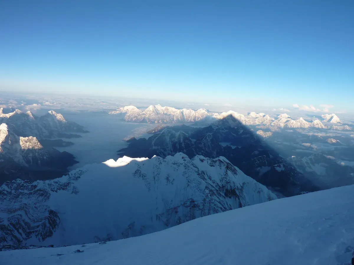
Sunrise from the summit of Everest toward Nuptse. Photo: Carlos Pauner, CC BY-SA 3.0, via Wikimedia Commons
Height Facts and Practical Tips
Do
- Do quote the height as 8,848.86 m (29,031.7 ft) because that is the official figure from the 2020 joint Nepal-China survey.
- Do say rock height when you cite 8,844.43 m, because China's 2005 figure measured the rock without the snow cap and comparing it with other figures confuses people.
- Do expect real altitude effects even at trekking level, because base camp at 5,364 m (17,598 ft) already sits above 5,000 m, the level Wikipedia gives as the usual starting point for Everest ascents.
- Do plan extra days between Namche Bazaar at 3,440 m (11,290 ft) and the higher villages, because the trail climbs from Lukla at 2,846 m to base camp at 5,364 m and the body needs time at each step.
- Do book flights and permits through a listing that states them clearly, because some trips include the Kathmandu-Lukla return and permits while others, such as the Island Peak listing with a climbing permit (USD 350 or USD 175) in its not-included list, leave them to you.
Don't
- Don't assume 8,850 m is current, because that figure comes from the 1999 National Geographic and Boston Museum of Science satellite survey and the 2020 survey superseded it.
- Don't call Everest the tallest mountain without qualification, because Mauna Kea's dry prominence of 9,330 m (30,610 ft) exceeds Everest's height and Chimborazo's summit is 2.1 km farther from the centre of the Earth.
- Don't treat the older printed figures as wrong, because 8,840 m in 1856, 8,847.73 m in the 1952-54 Survey of India work and 8,848.13 m in 1975 each measured with the best method of their time.
- Don't plan to stand on the summit of any listed trip that doesn't promise it, because treks and helicopter products reach base camp, Kala Patthar or a fixed route only, and no summit is guaranteed to anyone.
Mount Everest Height FAQ
How tall is Mount Everest in feet?
The official height is 8,848.86 m (29,031 ft 8.5 in) from the 2020 joint Nepal-China survey, often rounded to 29,031.7 ft. For context on how high that is against the points trekkers reach, see the Everest Base Camp guide.
How tall is Mount Everest in kilometres and mileage?
In metres the figure is 8,848.86 m, which reads directly as 8.84886 km above sea level. A distance in miles is not given in the sources, so none is converted here. The Everest Scenic Flight from $100 per person flies past Mount Everest, though a view is never guaranteed.
Is Mount Everest still growing?
Wikipedia gives the growth as about 2 mm per year. Read more on the trail through the high villages in the Namche Bazaar guide.
What is technically the tallest mountain on Earth?
It depends on the measure. Everest is highest above sea level at 8,848.86 m (29,031.7 ft). Mauna Kea's dry prominence of 9,330 m (30,610 ft) exceeds Everest's height, and Chimborazo's summit is 2.1 km farther from the centre of the Earth. You can compare viewpoints in the Kala Patthar guide.
Why does China say 8,844.43 m and Nepal say 8,848.86 m?
China's 2005 measurement of 8,844.43 m was based on rock height, excluding the snow cap, and Tibet Travel still quotes it. Nepal's figure of 8,848.86 m was agreed jointly with China in the 2020 survey. The north side base camp is covered by the Tibet Everest Base Camp Tour, $969 per person.
How high is Everest Base Camp compared with the summit?
Nepal's base camp sits at 5,364 m (17,598 ft), though some sources list 5,334 m, and the north base camp in Tibet is given as 5,200 m. Trekkers reach base camp on trips such as the Everest Base Camp 12 Days from $955 per person, while the summit itself belongs to mountaineers.